Nature’s Playground
There’s no place on earth quite like Wells Gray Park. With its ancient volcanic fields, glacier fed lakes, wildflower-strewn meadows, jagged mountain peaks and iconic waterfalls it begs to be explored on foot.
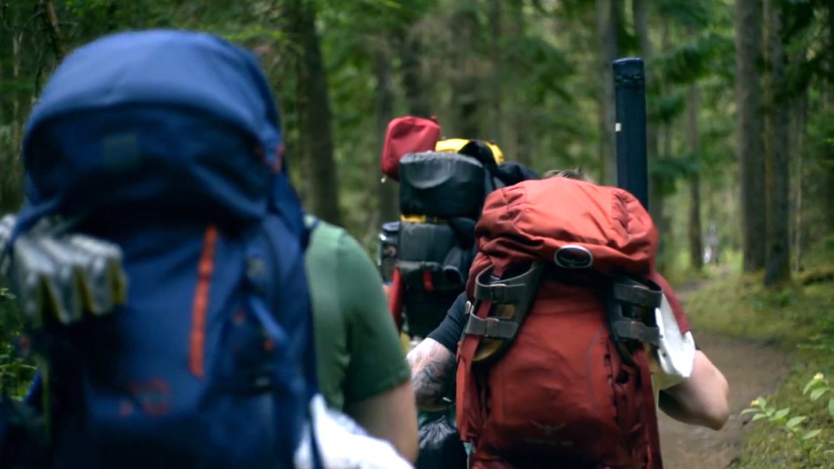
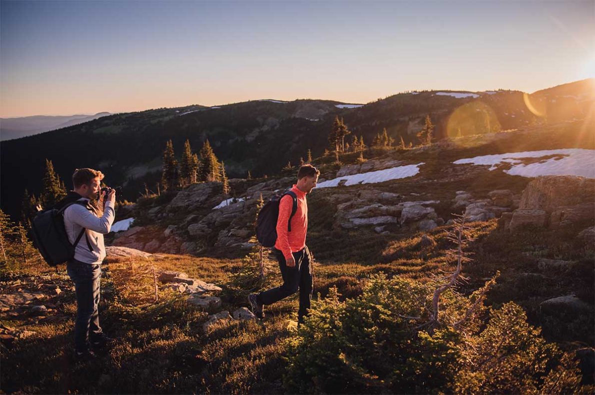
With over 200kms of hiking trails, you can find a trail that suites your hiking style. Whether you are looking for an easy or difficult hike, or long or short hike, you are sure to find a great adventure in Wells Gray and Clearwater. Take in mountain-top view from the Alpine, or follow a river deep into the forest. Hike through the valley to find a secluded waterfall.
Tip: For a full list of trails and conditions see BC Parks, Wells Gray Provincial Park page or Roland Neave’s book, “Exploring Wells Gray”.
Trophy Mountain Meadow
A one-hour hike (1km) that takes you through an old growth rainforest and high into the alpine. One moment you’re walking through deep forest and the next you’re standing in rolling alpine meadows surrounded by blooming wildflowers with stunning mountain peaks as your backdrop. In July and August, the endless fields of vibrantly coloured wildflowers make this one of the most popular hikes in the park. Hike just to the meadows or if you have more time, continue on the trail for an hour and fifteen minutes across lichen encrusted rocks to Sheila Lake and beyond.
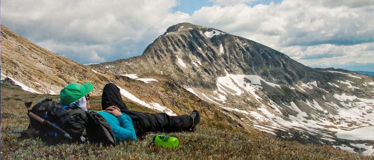
If it’s an epic ridge hike that you’re after soak up alpine solitude climbing across boulder fields to 2500 metres where panoramic views of Skyline Ridge (12 km round trip from the parking lot) are your reward for the trek.Because these ridges are over 2,500 metres, weather can change quickly. Therefore, you should be sure to carry a topographic map, compass, warm clothing, and extra food. Maps can be purchased at the Wells Gray Visitor Centre.
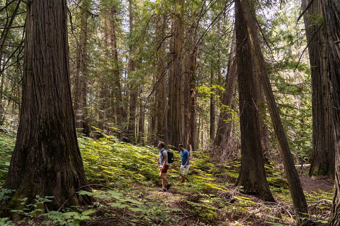
Grove Of Giants
This very short trail starts at the east end of the Spahats Falls parking lot, where one can wander into an old-growth Western Redcedar Hemlock forest peppered with informative interpretive signs.
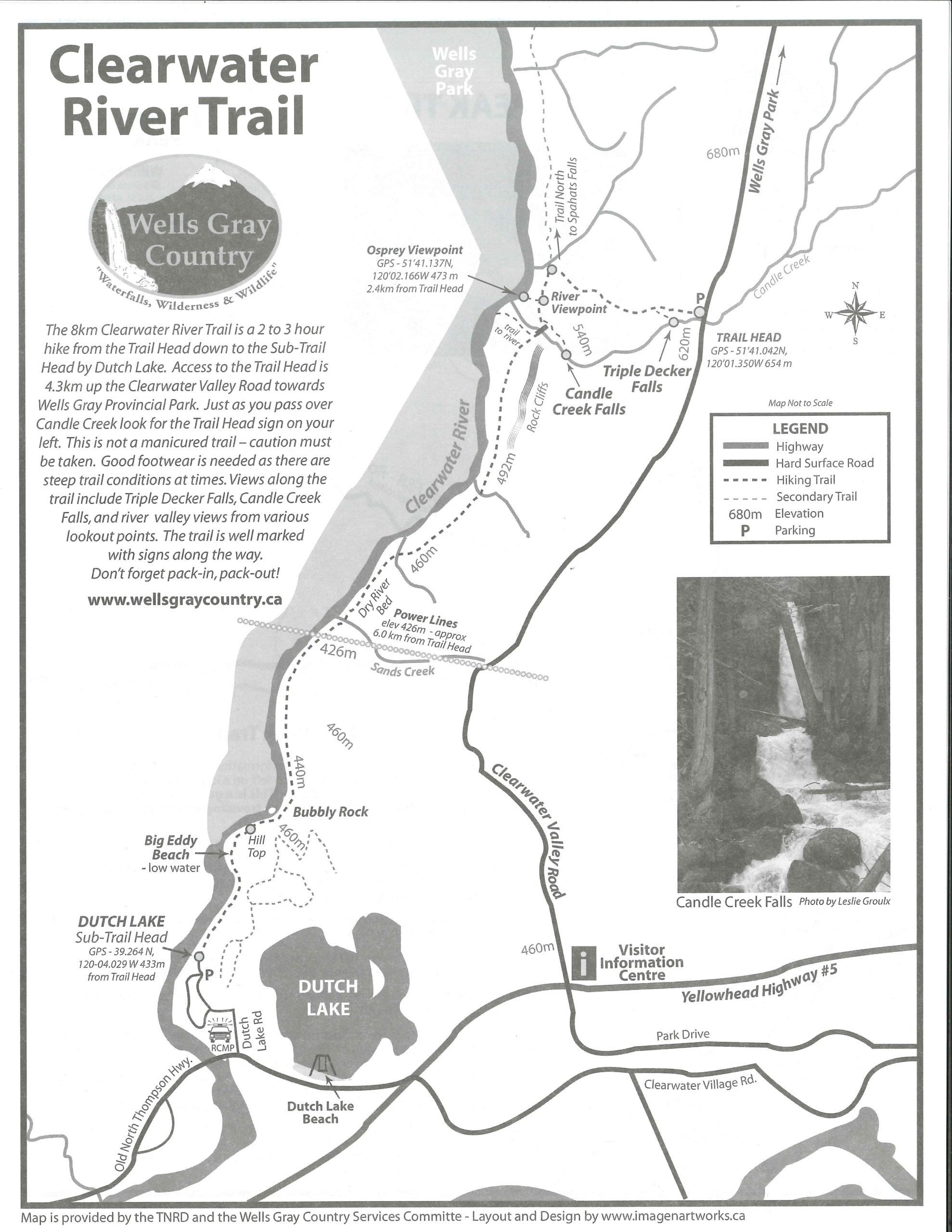
Clearwater River Trail
Another hike to enjoy on a hot summer day is the Clearwater River Trail which starts up in the park and continues 7kms back into the town of Clearwater. See several types of volcanic and river formations along the hike including bluffs, natural land bridges, the Triple Decker and Candle Creek Waterfalls and finish the hike along the Clearwater River. The Triple Decker Falls is the first of many amazing waterfalls that feature along the corridor of the park road and is a short 500 metre steep hike from the parking area. The Clearwater River Trail hike takes you through a wide variety of untouched landscapes and gives you a great variety of scenery for your hike.
Moul Falls and More
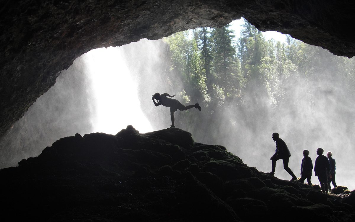
For a hike with a unique destination, be sure to do the one-hour hike to Moul Falls. A waterfall with a distinctive difference – you can experience the rush of this mighty 40 ft waterfall as you hike behind its misty veil. The perfect hike for a hot day; you can cool off at the base of the falls before you hike back through the forest to the parking lot.
For this and many more hikes to waterfalls including the Helmcken Falls South Rim Trail, Silvertip Falls, and West Lake Loop, see our list of the Top 15 Waterfalls to see in Wells Gray Country.
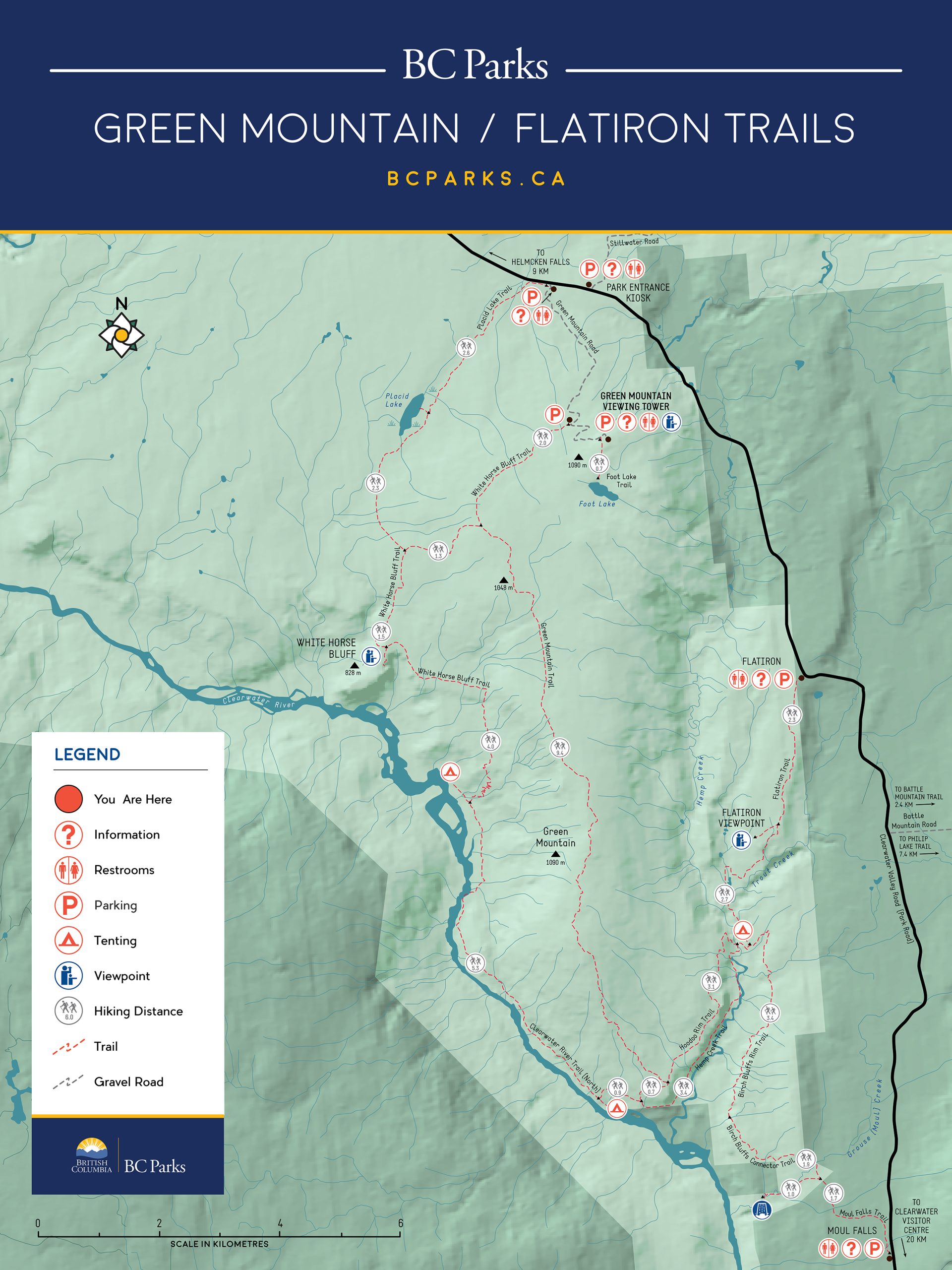
The Flat Iron Area and Whitehorse Bluffs
Flat Iron (20 kilometres return trip): Watch for parking lot on west side of road at 30.6 km. This trailhead provides access to a network of trails including Trout Creek, Hoodoo Rim, West Rim Tote, Clearwater River and White Horse Bluffs. These trails are popular with horse riders and with hikers.
Numerous points of interest and excellent views towards the Battle and the Trophy Mountains make this one of the most interesting trails in the southern portion of the park. A refreshing swimming hole at the base of Hemp Creek Falls, the Green Mountain Hoodoos, a volcanic cave and impressive views of river valleys and creek canyons make for a rewarding day trip. When crossing the south slopes of Green Mountain, note the well-browsed willows, a reminder of the large concentrations of moose and mule deer that spend the winter on these balmy slopes. Camp spots on the Clearwater River invite an overnight stay for a restful evening of casting for rainbow trout and dozing off to the rhythms of a wild river.
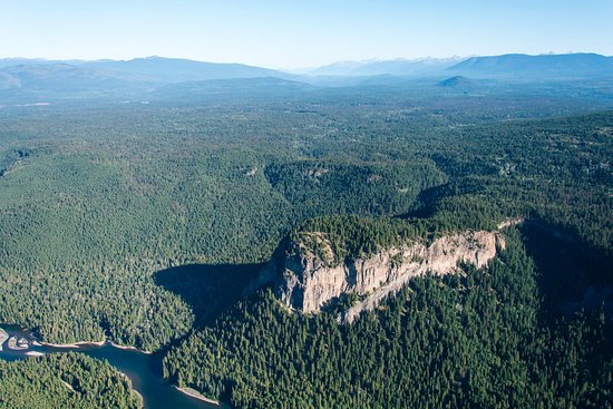
White Horse Bluff (11 kilometres return trip): A sharp bend on the road to the Green Mountain viewing tower marks the trailhead to White Horse Bluff. The initial part of the trail goes through a young forest of white birch and trembling aspen. This is good habitat for mule deer and black bear so be alert.
After about 40 minutes of walking, you come out onto the south flank of White Horse Bluff. The bluffs were formed when a volcano erupted under a lake that occupied the Clearwater Valley about 600,000 years ago. The surface of this lake would have been 250 metres above the current river level. From the bluff, you can enjoy spectacular views of the Clearwater Valley to the north and the forested slopes of Green Mountain to the south. This forest was purposely burned in 1971 to provide more winter habitat for moose. Keep a lookout for red-tailed hawks and bald eagles.
Placid Lake Trail (5 kilometres return trip): A parking lot located at the base of Green Mountain Road is the trailhead to Placid Lake. The trail passes huge cottonwood tress at the forest’s edge before meandering through an old-growth forest of large western redcedars and the occasional Douglas-fir. The trail continues through a much younger forest that has regrown since the great fire of 1926.
The trail opens up at the edge of Placid Lake. The lake is in transition, changing from a fen to a sphagnum bog, a process similar to that unfolding at Chain Lake. Enjoy the colourful aerial display put on by the nearly 50 species of dragonflies found here, or catch a glimpse of the occasional common loon or Barrow’s goldeneye floating on the lake’s surface. Watch your step in mid-summer because the area will be alive with newly hatched baby toads.
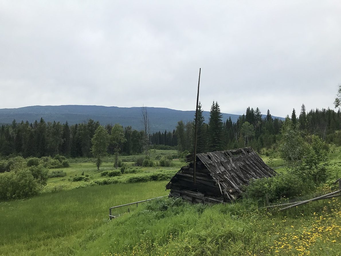
Majerus and Ray Farm
Majerus Farm/Blackwater Creek Trails (up to 32 kilometres return trip): Walk beside the Murtle River and gaze at the impressive profile of Pyramid Mountain on the north side of the river. Pyramid Mountain is a tuya, a volcano that exploded under a glacier. You will pass by the Majerus Farm, one of several abandoned farmsteads in Wells Gray. Notice how the forest is reclaiming the land.
For the summer adventurer, this trail can be hiked or mountain biked, but take insect repellent as the mosquitoes can be ferocious. During the winter, this same trail is mosquito-free and groomed for cross-country skiing.
The Majerus Farm Trail begins beside the warming hut just south of Dawson Falls. From the Majerus Farm, you can continue east along the Blackwater Creek Trail, which makes a loop back to the start
The Ray Farm (3 kilometres return trip): The Ray farm is one of the park’s few signs of the homesteading past. Built in the 1920’s, the farm consists of split rail fences, a farmhouse and two barns. The surrounding untended farm fields are home to Columbian ground-squirrels, red-tailed hawks and tree swallows. The farmhouse has since collapsed in the winter of 1998. Do not enter the building, as it is unstable.
Two approaches can be made to the Ray farm site. The most direct route follows an easy gravel path from the main parking area. The path passes several mineral springs which attract numerous mammals and birds; look for mammal tracks. By mid-July, the edge of these springs are often carpeted with yellow monkey flowers and white rein-orchids.
The second approach to the farm starts at the trailhead beside the Alice Creek parking lot. A gentle walk through a second growth forest will lead to the Ray mineral spring, a small (50cm high) volcano-shaped cone that bubbles with mineral water. Listen for summer songbirds like magnolia warblers, winter wrens, and American redstarts. Or, if you prefer, you can make the loop along Alice Lake Trail returning to the parking lot of choice.
South Rim
The 4 km long trail (one way) travels along the Murtle River to Helmcken Falls’ South Rim, where the hiker will feel the power of the water. The trailhead is located in the big bend west of Dawson Falls, just before crossing the single-lane bridge over the Murtle River.
Pyramid Mountain
From the trailhead near Pyramid Campground, one can hike 5 km to the top of this eroded volcano. Hikers can continue further to Majerus Falls and Horseshoe Falls, which adds another 5 km (one way only). There is a backcountry camping opportunity located next to the Murtle River at km 6 on the trail, 3 km past the intersection with Pyramid Mountain.
Gatling Gorge
This 3 km trail starts at Helmcken Falls viewpoint. It follows the rim to the confluence of the Murtle and Clearwater Rivers, to then travel upstream to reach this Class V rapid with steep walls on both sides.
Dragon’s Tongue
This short 1.5 km loop goes to this very old lava flow and to Sticta Falls. Geological interpretive signs will be installed in the summer of 2026. This trail starts across the road from Clearwater Lake campground.
Clearwater Lakeshore
Between Clearwater Lake campground and the boat launch, there is a 2.6 km trail that follows the shores, with a few bridges around rocky bluffs. This is an easy family family-friendly option to see the lake if you are not planning to go on a boat, canoe or kayak.
Osprey Lookout, Chain Meadows and Easter Bluffs
This is a loop near Clearwater Lake that offers a few variations. On the east side, at the same trailhead as Dragon’s Tongue, one can hike to Osprey Lookout, which is 1 km long with 100 m of elevation. This viewpoint provides gorgeous views of Osprey Falls. Hikers can continue further to Chain Meadows and Chain Lake. This hike totals 13 km and ends at the Clearwater Lake boat launch. Others will opt to hike from the boat launch to Easter Bluffs, which is 4 km one way with 260 m ofelevation gain. This option starts by following the lakeshore with its large cedars and then climbs to a unique rock formation and a viewpoint, offering a generous vista of Clearwater Lake.
Eagle’s Nest
If you are exploring Clearwater Lake on a boat, canoe or kayak and want to go for a hike, this one is for you. This trail starts at Diver’s Bluffs campground and climbs 1.5 km with 220 m of elevation gain to a rocky outcrop in the forest, offering easterly views of Clearwater Lake.
Murtle Lake:
Wavy Range
This is one of the most popular hikes at Murtle Lake. This trail starts just north of the Strait Creek campground and climbs through the forest to the alpine in 7 km with 900 m of elevation gain. Once in the alpine, there are some wildflowers present in July.
Because these ridges are over 2,200 m, the weather can change quickly. Therefore, you should be sure to carry a topographic map, compass, warm clothing, and extra food.
McDougall Falls
The McDougall Falls hike starts in the Diamond Lagoon. Use extreme caution in the lagoon by staying away from the outflow of the Murtle River, as it has very strong currents. The trail is 5 km one way to the most northern waterfall on the Murtle River (a total of 6 waterfalls on this river).
Central Mountain
This is another big alpine objective on Murtle Lake. This hike climbs steedily to the top of Central Mountain, offering beautiful views of the Caribou Mountains to the north. This trail is 7 km long one way with 1000 m of elevation gain.