If you’re planning a hike to Trophy Mountain Meadows in Wells Gray Park, here’s the latest update on current trail and wildflower conditions.
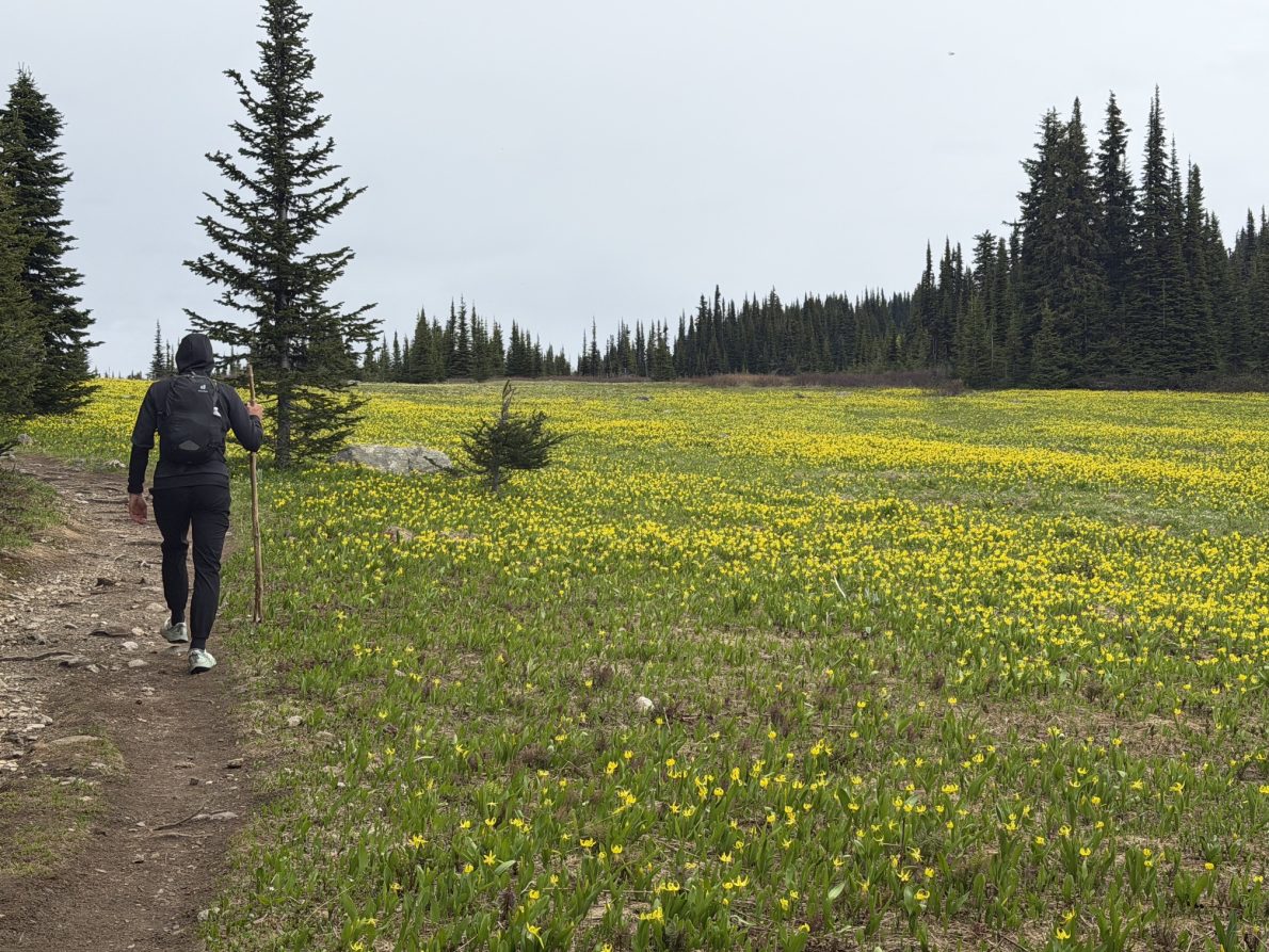
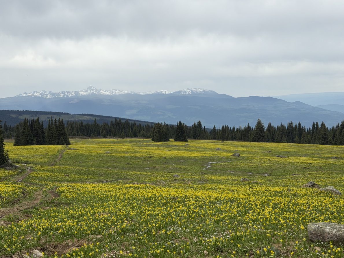
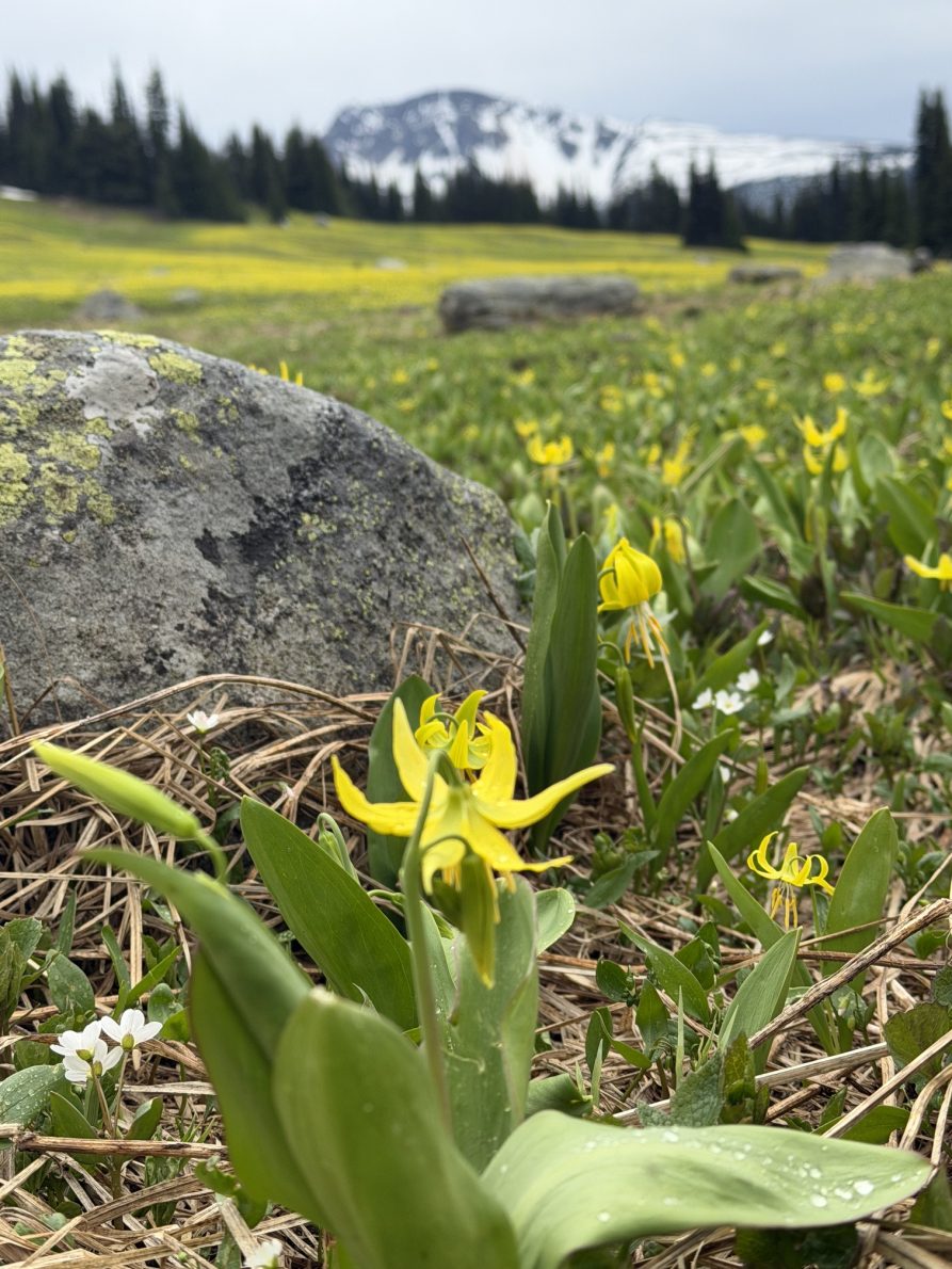
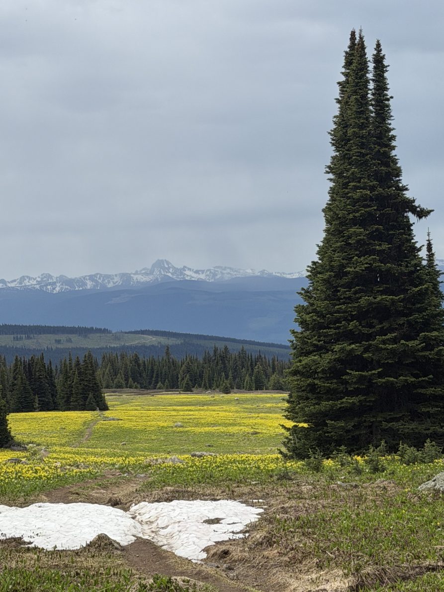
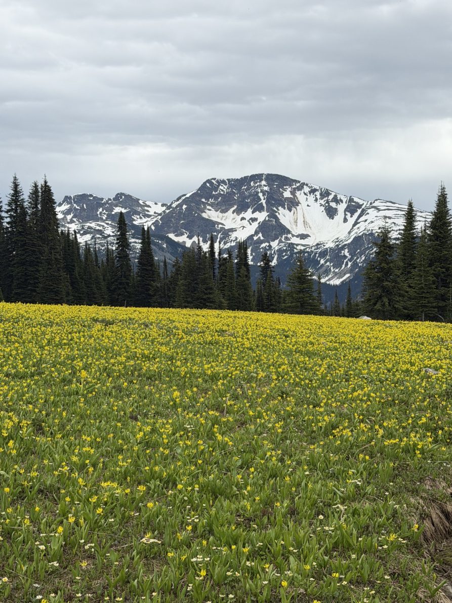
The first glacier lilies of the season are now blooming throughout the meadows, marking the beginning of the annual wildflower season. Visitors can already enjoy patches of bright yellow flowers emerging from the melting snow, creating one of the most unique displays of the year.
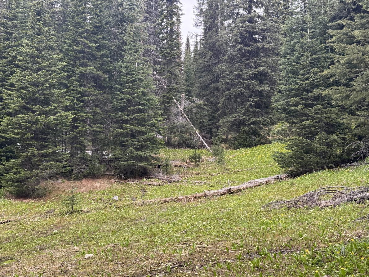
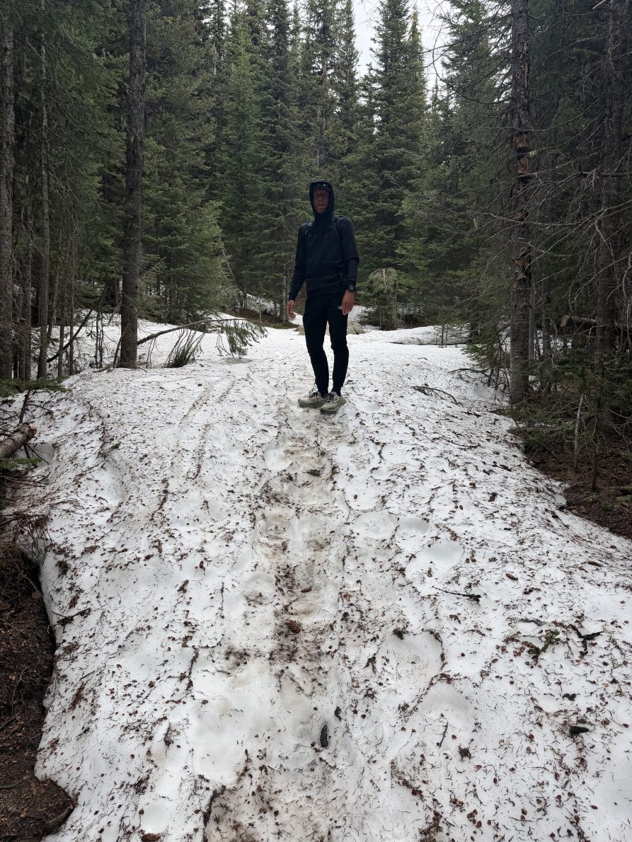
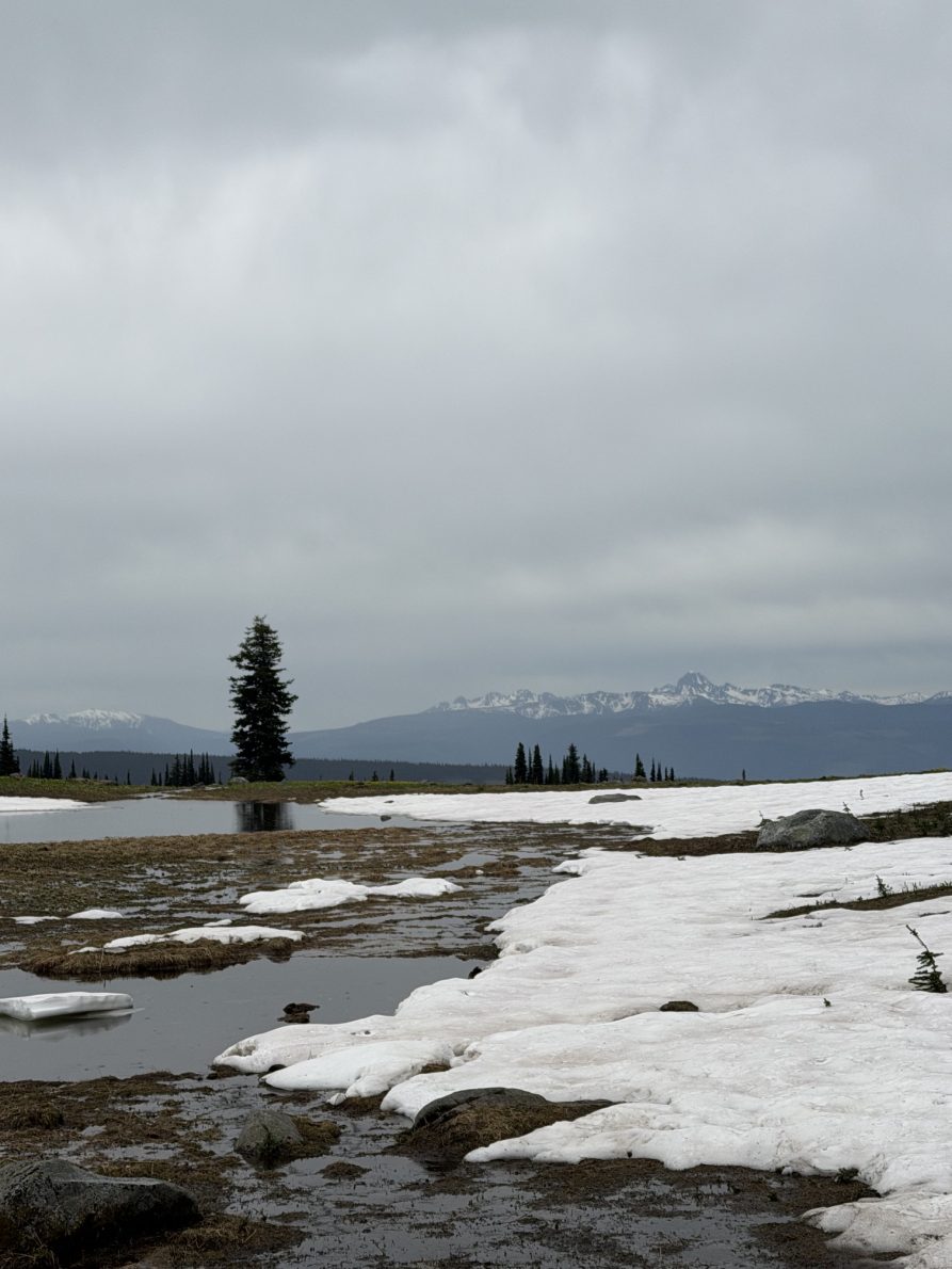
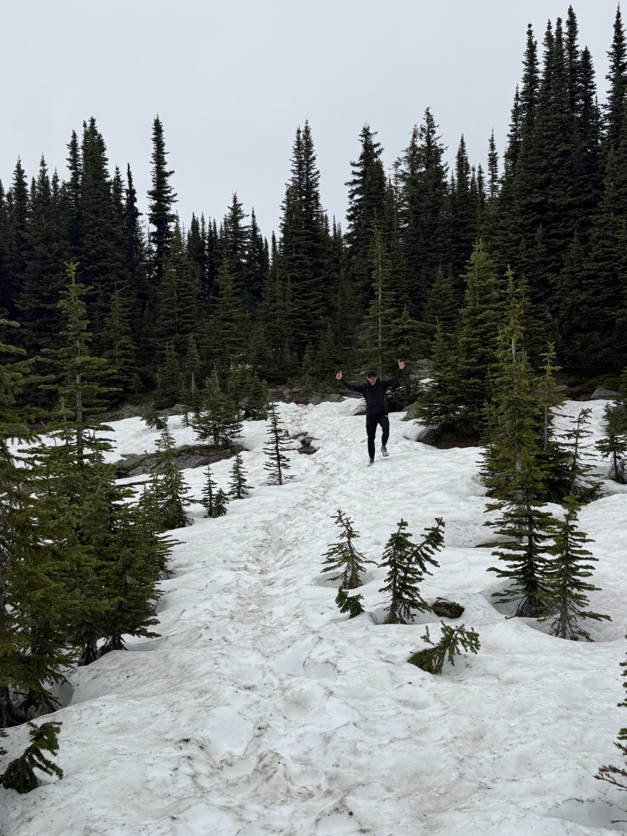
While the wildflower season is underway, hikers should be aware that there is still significant snow coverage on parts of the trail and throughout the alpine. Conditions can change quickly depending on weather and temperatures, and visitors should be prepared for snow, wet sections, muddy areas, and cooler mountain conditions.
When is the Best Time to Visit?
The timing of wildflower blooms varies slightly each year depending on snowpack and weather conditions.
Late June to early July is typically the best time to see glacier lilies at their peak as they emerge from the receding snow.
Mid-July to late July is generally considered the peak wildflower season, when a wider variety of alpine flowers blanket the meadows in colour.
Trail Conditions
- Snow remains on sections of the trail and throughout the alpine.
- Wet and muddy conditions should be expected.
- Proper hiking footwear is strongly recommended.
- Mountain weather can change quickly, even on warm summer days.
- Visitors should carry water, extra layers, and be prepared for variable conditions.
Before You Go
Trophy Mountain Meadows is one of the most popular hikes in Wells Gray Park and offers spectacular views, alpine wildflowers, and a unique mountain landscape. As conditions continue to improve over the coming weeks, visitors can expect more snow to melt and additional wildflower species to begin blooming.
We’ll continue to provide updates throughout the season as conditions evolve.
Last updated: June 2026 with images below provided from a recent visitor on June 15th, 2026.
📍 Getting There & Trail Overview
Trailhead access:
- 11.3 km north from Clearwater on Clearwater Valley Road, then turn onto rough Road 80 (Spahats Creek Forest Service Road). The drive 13 km and a gravel road; a high clearance vehicle is recommended, though 4WD isn’t mandatory.